First you will need to download Tableau software. If you already have it great. If not, you can obtain a student trial if eligible, or download the public version of Tableau here by registering. Tableau can be expensive to obtain. I use the public version mainly because it is free and the data is saved on the tableau public server. Though in public version the work is unhidden from others. If you don’t mind other’s looking at your work, use Tableau public it’s an awesome tool for visuals.
This introduction will briefly show geo spatial visualization of data with Tableau. Tableau is very efficient in reading geographic data. It can read names, lat-long and FIPS codes (USA). I usually use FIPS codes when working with geographic visuals. Since many datasets are not consistent in naming locations, for example NYC vs New York City. FIPS is a unique code that identifies cities, counties and states in the United States. You can see here I use Fips code to work with geo data.
This introduction will not use FIPS since I am only using State names.
The CSV file used for this is located here.
I cleaned up the data set a bit. Leaving only States and population estimates for five years.
To start.
Open Tableau public.
Open the file as a "text" file.
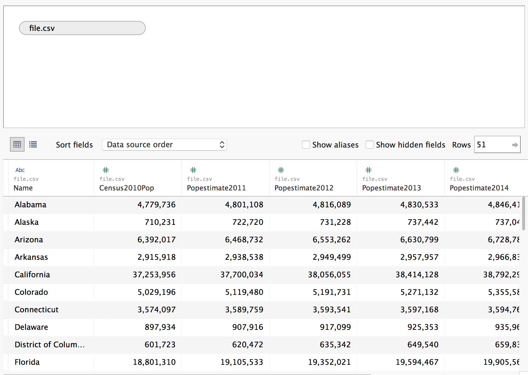
The data should look something like this, with named geo locations.
Go to the worksheet (Should be named sheet1).
Tableau does not recognize State names right away, so we have to give our State name column a role.
Right click the column with State names. Scroll to Geographic role and click State/Province.
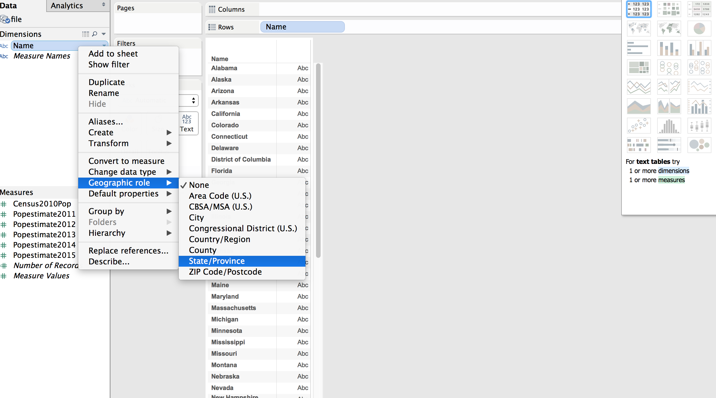
A lat-long is generated for states.
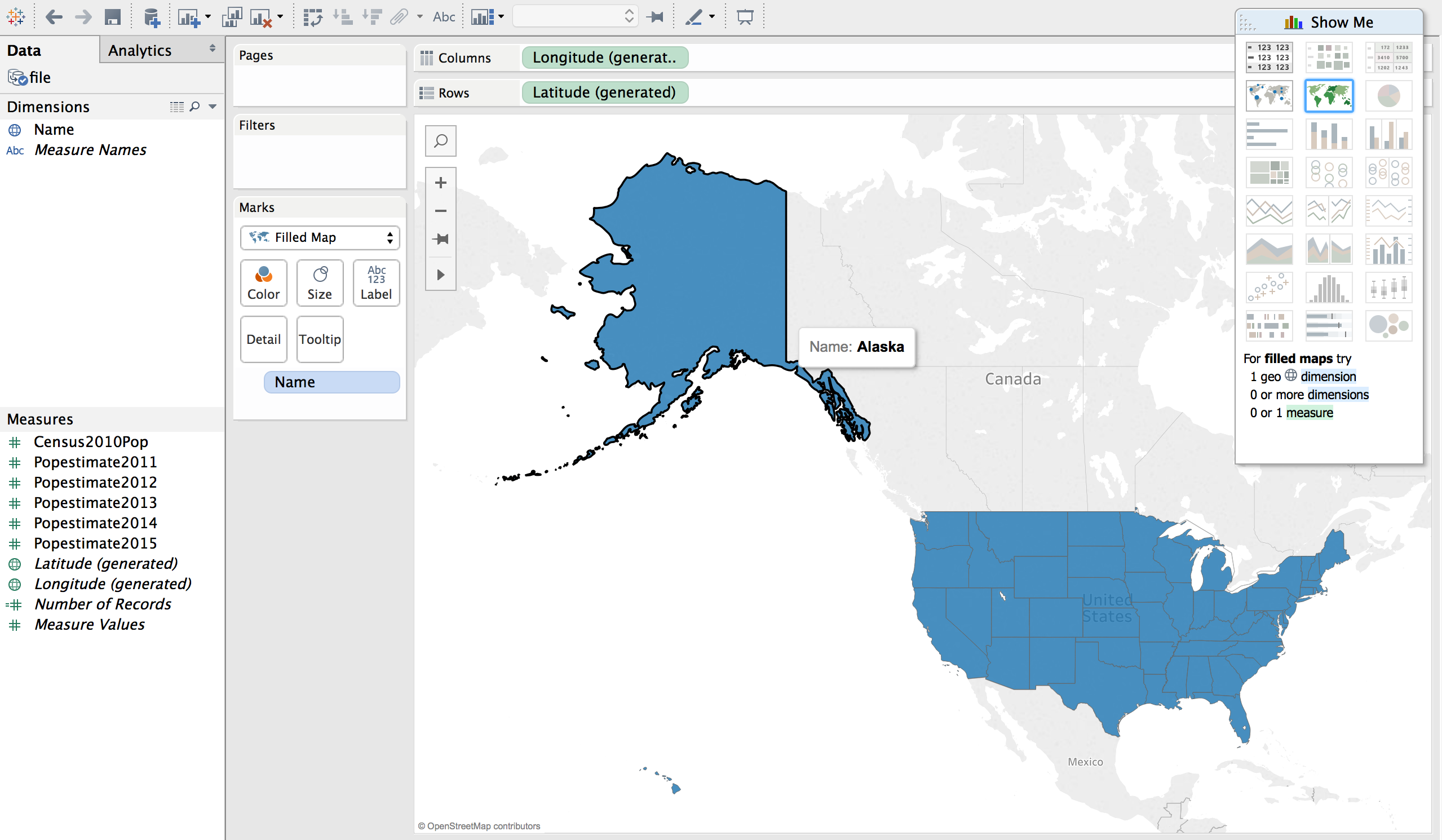
Click quick tool bar on the right (Show Me) for filled maps. Or choose it under Marks.
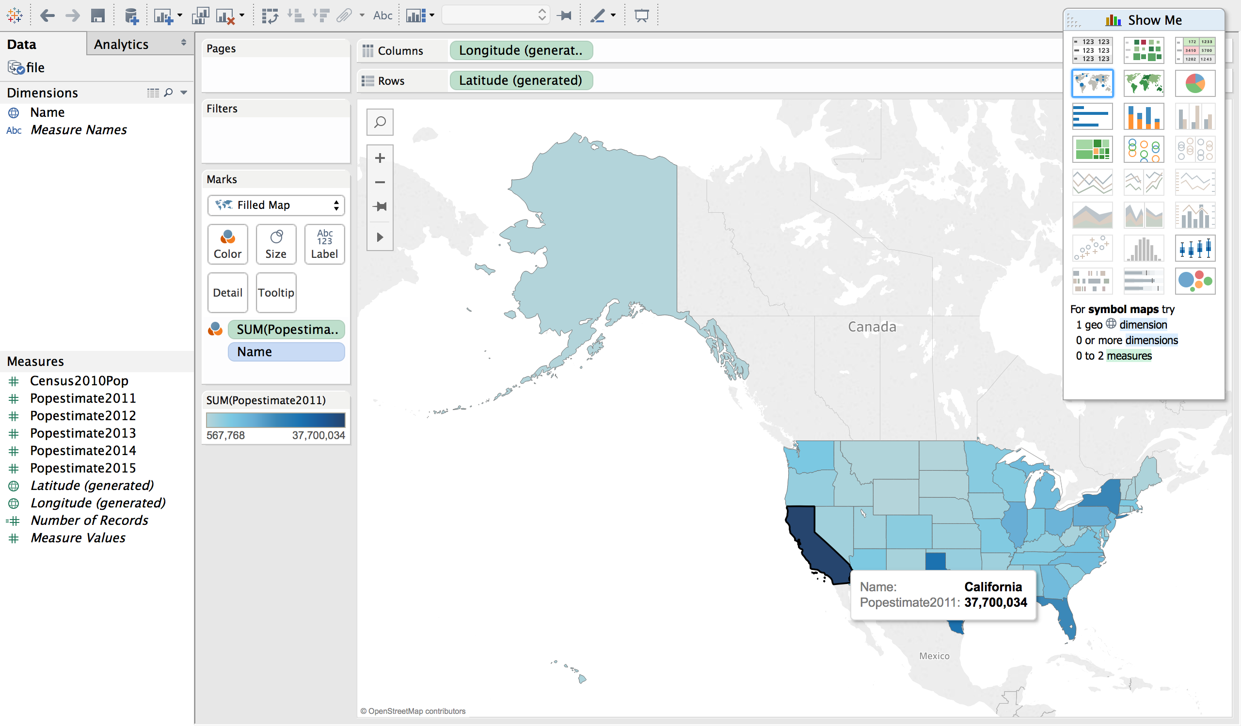
To see the effects of numerical data on geo location drag one of the population estimates on to color in Marks. You can also change the colors under Marks if needed.
You can create story in many different ways with tableau. Many other visuals can be generated.
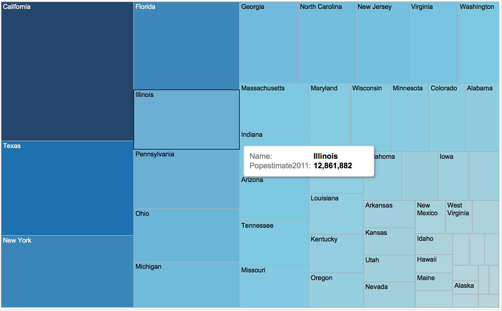
Ex. Treemaps
Again, tableau is an awesome tool for Business Intelligence, Geogrpahic data, finance, marketing and much more.